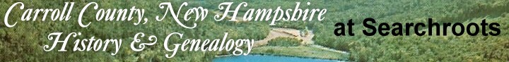
|
This
web site is a resource for researchers of family tree
(genealogy)
and history in Carroll County, New Hampshire.
HISTORY | DOCUMENTS
| OTHER AREAS OF RESEARCH
MAP OF CARROLL COUNTY | TOWNS/CITIES
IN CARROLL COUNTY
For
Help with Researching your family tree,
see HISTORY & GENEALOGY OF NH (Main Site)
BRIEF
HISTORY OF CARROLL CO., NEW HAMPSHIRE
BRIEF
HISTORY OF CARROLL CO., NEW HAMPSHIRE
Carroll County was created by an act of the state
legislature approved December 23, 1840, which also
formed Belknap County. The language of the act concerning
the towns embraced in Carroll county is "the
said county of Carroll shall contain all the lands
and waters included within the following towns and
places, which now constitute a part of the county
of Strafford, to wit: Albany, Brookfield, Chatham,
Conway, Eaton, Effingham, Freedom, Moultonborough,
and the said towns be, and the same are herby, severed
and disannexed from the county of Strafford."
By an act of the legislature approved January 5,
1853, Bartlett, Jackson, and Hart's Location were
disannexed from the county of Coos and annexed to
Carroll county. Boundaries between Belknap and Carroll
counties were established in 1841, thus: "Beginning
at the easterly termination of the line dividing
the towns of Meredith and Moultonborough; thence
running easterly to the southerly point of Long
Island in Winnipisseogee lake; thence easterly to
the westerly termination of the line dividing the
towns of Wolfborough and Alton; and all the lands
and waters lying northerly of said line and between
that and said towns of Moultonborough, Tuftonborough,
and Wolfborough shall constitute a part of said
county of Carroll." The town of Madison was
incorporated from the western part of Eaton in 1852.
Carroll
county received it names in commemoration of Charles
Carroll of Carrollton, one of the most distinguished
of the signers of the Declaration of Independence,
and by the diversified and lovely character of its
bewitching scenery is keeping the name of a household
word in the cultured minds of both the old and new
worlds.
Strafford county, from which Carroll was formed,
was one of the five original counties of New Hampshire,
being made by the same act which created Rockingham,
Hillsborough, Cheshire and Grafton, March 19, 1771.
Many of the towns in Carroll have a much older corporate
existence than the county, and some of them are
as old as the five first counties. The early or
pioneer stage belongs here rather to the towns than
to the county.
Carroll county contains an area of nearly six hundred
square miles, is surrounded on the north by Coos
and Grafton counties, east by York and Oxford counties
in Maine, southeast by Strafford county, southwest
and west by Belknap and Grafton counties, and lies
between 43" 28' and 44" 35' north latitude,
and 3" 20' and 6" 10' longitude east from
Washington.
In 1880 the entire population of Carroll county
was 18, 291, and improvement over 1870 which showed
17,332, and a falling off from 1860 which gave 20,
465, and from 1850, which was 20,157. The highest
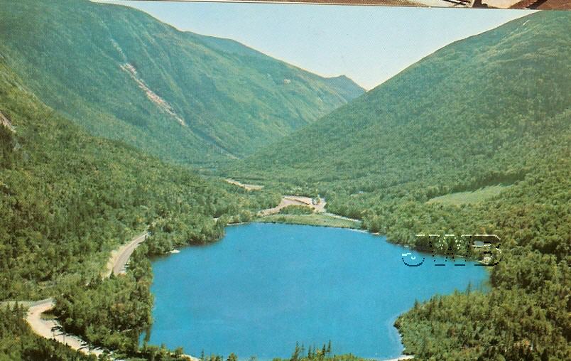
peaks within the county include: Mt. Washington,
6293 ft; Mt. Adams 5,794; Mt. Jefferson, 5,714 ft.;
Mt. Clay, 5,553 ft; Mt. Monroe, 5,384 ft; Mt. Little
Monroe 4,204 ft.; Mt. Madison 5,365 ft; and a number
more over 4,000 feet.
There are several boulders of note: The Conway Boulders
in North Conway aka the Pequawket boulder; the Washington
Boulder northwest of Conway Centre near Pine Hill;
the Bartlett Boulder; Ordination Rock in Tamworth;
and Madison Boulder, the largest of these glacial
'travelers' in the northwest part of Madison NH.
Its county seat is OSSIPEE.[from
the History of Carroll County, New Hampshire by
Georgia Drew Merrill; Boston: W.A. Fergusson &
Co., 1889]
The county seat of Carroll County is Ossipee
NH.
DOCUMENTS
(this site) for genealogical research
OTHER
AREAS OF RESEARCH FOR CHESHIRE COUNTY (this site)
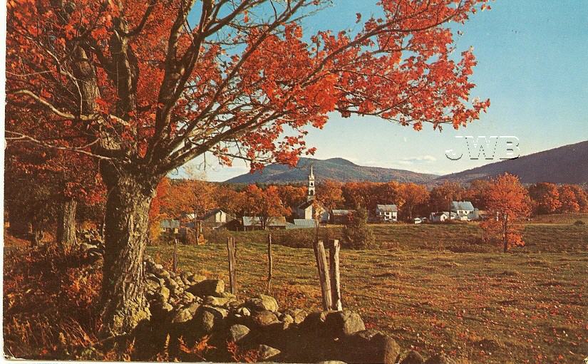
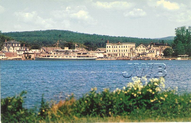
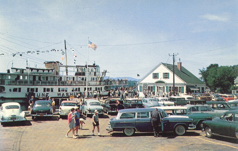
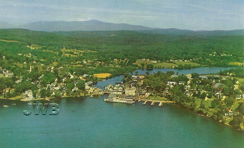
PHOTOGRAPHS
(also see individual towns):
- Multiple
Old Postcards from throughout Carroll County NH
- USGenWeb
- Subalpine
scrub Abies balsamea and Picea, White Mountains, New
Hampshire (Carroll County) - American Environmental
Photographs, 1891-1936, American Memory
- Subalpine
fir and spruce [and] bare granite rock, White Mountains,
New Hampshire, Carroll County, American
Environmental Photographs, 1891-1936, American Memory
- Fir
and Spruce forest just below the upper limit of forest
growth, White Mountains, New Hampshire (Carroll County),
American
Environmental Photographs, 1891-1936, American Memory
- Looking
north [to] Abies balsamea [at] twenty feet [on the]
three thousand five hundred foot slope [of] Mt. Chocorua,
White Mountains, New Hampshire (Carroll County)
- American Environmental Photographs, 1891-1936, American
Memory
- BUSINESS:
- FUN:
- NEWS
IN CARROLL COUNTY (newspapers & online):
- MAPS:
If
you are looking for town/city specific resources, click
on the town map.
For other resources
within Carroll County. If you want to know about
general genealogy resources (such as how to find vital
records, deeds and other documents), visit the "Genealogical
Research" section.
Current communities in Carroll County include:
Albany, Bartlett,
Brookfield, Chatham,
Conway, Eaton,
Effingham, Freedom,
Hart's Location, Hale's
Location (unincorporated place), Jackson,
Madison, Moultonborough,
Ossipee, Sandwich,
Tamworth, Tuftonborough,
Wakefield, Wolfeborough.
TOWNS
/ CITIES IN CARROLL COUNTY, New Hampshire
ALBANY
- Brief
History: Originally in Strafford County, Albany
then became part of Carroll County when it was formed.
This town lies 60 miles N. by E. from Concord (NH)
and 67 NNW from Dover. The principal river in Albany
is the Swift River, which passes from west to east
into the Saco, at Conway. There are several small
streams in different parts of the town, along with
several lofty hills and mountains. The highest mountain
is called Chocorua, and it received its name from
an Indian (Native American) who was killed on the
summit by a part of hunters in a time of peace,
before the settlement of the place. There are some
intervale lands on the borders of Swift river. The
town was granted November 6, 1766 to Clement March,
Joseph Senter and others, and until 2 July 1833,
it bore the name of Burton. Population in 1830 was
325. .
- Villages
and Place Names:
Burton, Ferncroft, Passaconaway, Fergus Mills
- PROFILE
& STATISTICS:
- GOVERNMENT:
- OTHER
WEB SITES:
- History
& Genealogy: Alexandria, N.H.
- History
& Genealogy of Albany NH -
chapter from History of Carroll Co. NH
- Digital
Collections, Town of Albany NH
- from UNH (includes town reports)
- Annual
reports of the officers of the Town of Albany
for the fiscal year ending: 1883, 1901, 1903,
1925-1927, 1929, 1932-1950, 1952-1963, 1964-1967,
1969-1984, 1986, 1989, 1990, 1992, 1996-1997,
1999, 2000-2003 [includes vital statistics, birth
marriage and death of residents]
- PHOTOGRAPHS/POSTCARDS:
- BUSINESS:
- MAPS:
BARTLETT
- Brief
History: Bartlett was located in Coos County
until Carroll County was formed. This town is located
45 miles S.E. from Lancaster, 82 NNE from Concord,
and 85 NNW from Portsmouth. It lies at the foot
of the White Mountains on the eastern side. The
Saco River meanders through the center of the town
and is the principal stream. In the northern part
of the town occurs one of the most extensive deposits
of workable iron ore ever found in New Hampshire.
Farming is the principal employment. Bartlett was
incorporated June 16, 1790 and received its name
in honor of Governor Josiah Bartlett. In 1830 its
population was 644. Some of the early hotels here
were Bartlett House, East Branch House and Pequawkett
House. When the Portland and Ogdensburg railroad
was built it passed through this town..
- Villages
and Place Names: Bartlett Village, Upper
Bartlett, Glen (Central Bartlett), Cooks Crossing,
Goodrich Falls, Jericho, Intervale, Dundee, and
West Side Road, Stark's Location
- Profile
& Statistics:
- GOVERNMENT:
- OTHER
WEB SITES:
- History
& Genealogy:
- History
& Genealogy of Bartlett NH - from
chapter of History of Carroll Co. NH
- Bartlett
NH Obituaries (from Historical Society Web
Site)
- Saco
Valley Settlements And Families, by G.T.
Ridlon, Sr., 1895 - Online book at Internet
Archive
- Annual
Report of the Town of Bartlett, New Hampshire,
including VITAL STATISTICS (births, marriage
and deaths) for the years:1885, 1892, 1895,
1925-1927, 1929, 1931, 1936-1937, 1939-2006
- internet archive
- Biography:
Bartlett New Hampshire’s Author, Lady
Blanche Elizabeth Mary Annunciata (Noel) Murphy
(1845-1881) - Cow Hampshire
- Biography
and Likeness of Hon.
George W. Pitman
- Biography
and Likeness of Samuel
Pendexter
- Biography
and Likness of Charles
Carroll Pendexter
- Biography
and Likeness of Solomon
D. Pendexter
- Biography
and Likeness of Hon.
Joseph Pitman
- nnn
- BUSINESS:
- PHOTOGRAPHS
& POSTCARDS:
- MAPS:
BROOKFIELD
- Brief
History: Brookfield was a part of the early
township of Kingswood, which existed only on paper,
later it formed a part of Middleton, which was created
in 1778. In December 1794 Brookfield was incorporated,
and William Chamberlain was appointed to call the
first town-meeting and act as moderator. Nicholas
Austin first settled here a few years before it
was incorporated. The town of Brookfield NH is separated
from Middleton by Moose and Willey mountains. Copple
Crown, another mountain is almost the dividing line
between Brookfield and New Durham. Tumble-down Dick
lies wholly in Brookfield. A small pond, 1-1/4 mile
long and 3/4 of a mile wide, known as Cook's Pond,
is the source of one branch of Salmon Falls River.
Brookfield is 45 miles NE of Concord. A branch of
the Salmon Falls River has its source in Cook's
Pond in this town, that pond being the largest body
of water. Farming and logging traditionally are
the chief occupations.Brookfield is bounded on the
north by Wolfeborough and Wakefield, east by Wakefield,
south by Middleton, and west by Durham and Wolfeborough.
When the railroads were active, the Wolfeborough
Branch Railroad passed through this town. [from
New-Hampshire Gazetteer and History of Carroll Co.
NH]
- Villages
and Place Names: Kingswood, Middleton
- Profile
& Statistics:
- GOVERNMENT:
- Brookfield
Town Clerk
267 Wentworth Road
Brookfield, NH 03872
Phone: (603) 522-3688
- Gafney
Library [shared library in Wakefield NH]
14
High Street
Wakefield, NH 03872
Phone: (603)-522-3401
Fax: (603)-522-7123
- Wakefield-Brookfield
Historical Society
2851 Wakefield Road
Wakefield Corner
Wakefield, NH 03830
- History
& Genealogy:
- History
& Genealogy of Brookfield, NH
- from History of Carroll Co. NH
- History
of Brookfield NH, Historic Photos, People
and Places, Town Reports and Vital Records (from
the official town web site)
- Some
OLD Brookfield/Wakefield marriage records
- from town web site (PDF)
- Annual
Reports of the Town of Brookfield, NH
INCLUDING VITAL RECORDS (births, marriages and
deaths local) for the years following: 1891, 1894-1897,
1902, 1925-1927, 1935-1962, 1965-2008
-
The
town register: Farmington, Milton, Wakefield,
Middleton, Brookfield, 1907-8 - Davis, Byron
V., - internet archive
- PHOTOGRAPHS/POSTCARDS:
- MAPS:
CHATHAM
- Brief
History: Chatham was granted by Governor Benning
Wentworth, February 7, 1767 to seventy-three grantees.
It was laid out ten miles long and four wide, and
named for Lord Chatham. It is bounded north by Bean's
Purchase, east by Maine, south by Conway, west by
Bartlett, Jackson and Bean's Purchase. Baldface
Mountain towers 3,600 feet high in the northwest
part of the town. From Baldface stretches southward
a great mountain wall composed of Gemini, Eastman,
Sloop and Kearsarge mountains. The town contains
gem mines, i.e. white topazes, lapis lazuli, beryls,
garnets, etc. When Coos County was formed (1805)
Chatham was one of its towns, remaining so until
1823 when it was given to Strafford County, then
it was one of the original towns of Carroll County.
The first settlement of the town was at South Chatham
when Nathan Ames lived there in a log house with
his family, building a saw and grist mill. In 2013
it was the fifth smallest community in New Hampshire.
- Villages
and Place Names:
Chatham, North Chatham, South Chatham
- Profile
& Statistics:
- GOVERNMENT:
- Chatham
Board of Selectmen
Wayne
McAllister, Chairman
1681 Main Road
Chatham, NH 03813
(603) 694-3827
- HISTORY
& GENEALOGY:
- History
& Genealogy of Chatham NH
- from
History of Carroll Co. NH
- Annual
Report of the Town of Chatham, N.H. with Vital
Statistics for the Years: 1905, 1909,
1925-1927, 1929, 1934-1935, 1937-2007.
- Chatham
Historical Society
Barbara Eastman
1209 Main Road
Chatham NH 03813
(603) 694-3623
- Biography
& Likeness:Ithiel E. Clay,
b 26 August 1819 in Chatham NH. He was a surveyor,
lumberman, and farmer. He taught school when
he was 20 years old. In civic affairs he was
postmaster of Chatham for 16 years, justice
of the peace, selectman and town clerk. He was
representative for the town fro 1859-60 and
1881-84.
- Biograpical
Sketch: Asa Eastman
was a descendant in the sixth generation from
Roger Eastman the immigrant, great-grandson
of Capt. Ebenezer Eastman a grantee of Penacook/Concord,
and son of Jonathan and Molly (Chandler) Eastman
of Concord, where he was born 5 December 1770.
He died 16 August 1818.
- PHOTOGRAPHS/POSTCARDS:
- MAPS:
CONWAY
- Brief
History: Conway was settled when Daniel Foster
obtained a grant for this township 1 October 1765.
Between 1764-1766 James and Benjamin Osgood, John
Dolloff, Ebenezer Burbank and others began to live
here (and was the first White Mountain town to be
settled). Its boundaries are north by Chatham and
Bartlett, east by the State of Maine, south by Eaton
and Madison and west by Madison and Albany. The
Swift, Peequawket and Saco are the principal rivers
of this town, with Walker's Pond and Pequawket Pond
as principal collections of water. Notable elevations
are Pine, Rattlesnake, and Greene hills. Some of
the finest views of the White Mountains are obtained
from the northern part of this town. Early hotels
were Conway House, Grove Hotel, Pequawket House,
Kiarsarge House, Sunset Pavilion, McMillen House,
Washington House, North Conway House and Interval
House.
- Villages
and Place Names: Center Conway, North Conway,
Intervale, Kearsarge, Quint, Redstone, South Conway
- Profile
& Statistics:
- GOVERNMENT:
- HISTORY
& GENEALOGY:
- Conway,
New Hampshire annual reports
(including births, marriages and deaths) for
years: 1925-1926, 1929, 1936-1965, 1967-1990,
1994-1998, 2000-2003
- Conway
Vital Statistics since 1880 - Conway Library
- A
History of Conway, New Hampshire For Use
in the Social Studies Program of the Fourth
Grades in the Conway School District, by Barbara
Smart Lucy - PDF
- The
Fifty First Selectmen of Conway NH - NHGenweb
- History
& Genealogy of Conway NH
- from History of Carroll Co. NH
- Earliest
Settlers of Conway NH
-
History of Carroll County, New Hampshire, by
Georgia Drew Merrill, 1889
- Blog:
North Conway New Hampshire Actor and Producer:
Gordon
A. Clapp (1948-still living) - Cow Hampshire
- Stonehurst
Manor history
(now a Hotel in N. Conway NH)
- Eastman
Lord House Museum
- Conway NH
- Climbing
History in Conway NH
- CONWAY:
Biographies/Info Conway People, GEDCOM of
Conway Settlers, Eastman Family Index - online,
Conway Public Library
- Saco
Valley Settlements And Families, by G.T.
Ridlon, Sr., 1895 - Online book at Internet
Archive
- Biographies
of Some Conway New Hampshire People
including: Albert Barnes, Elijah B. Carlton,
Benjamin Franklin Clark, Henry B. Cotton, Frank
Westcott Davis, Capt. Andrew Dinsmore, Clement
Drew, Thomas Crosby Eaton, Jerome B. Fellows,
H. Boardman Fifield, Samuel N. Greenlaw M.D.,
B. Frank Horne, M.D., Alpheus Crosby Kennett,
Albert C. Lovejoy, John McMillan, Ormand W.
Merrill, Joel Eastman Morrill, Herbert Stephen
Mudgett, Lory Odell, Henry Harrison Randall,
George Hosley Shedd, M.D., John Ziba Shedd,
M.D.,Jerome Van Crowninshield Smith, M.D., Edwin
Snow, William D. Tasker, Christopher Walker
Wilder, Benjamin Glazier Willey.- PDF
- Bio:
Pinkham
Notch, New Hampshire AMC Hut Manager and Co-founder
of Mt. Washington Observatory, Joseph Brooks
Dodge Sr. (1898-1973) - from Blog, Cow
Hampshire
- Biographical
Sketch & Likeness: Nathaniel
R. Mason
- Biographical
Sketch & Likeness: Hiram
Calvin Abbott
- Biographical
Sketch & Likeness: Leanders
S. Morton
- Biographical
Sketch & Likeness: Joel
Eastman Morrill
- Biography
and Likeness:
Joel Eastman of Conway NH
- Biography
of Lady
Blanche Murphy
- Early
History of CONWAY NH - Conway Public Library
(pdf)
- CONWAY
NH Vital Statistics (Births, Marriages &
Deaths) - Online, Conway Public Library
[archived version]
- CONWAY
NH Cemetery records - online from Conway
Public Library
- CONWAY
NH Obituaries 1999-2001 - Conway Public
Library (contact them for other years)
- CONWAY:
Kennett High School Graduates (last name,
first name, village and year graduated)- online
from Conway Public Library
- CONWAY
NH Historical Society web site
- List
of Cemeteries in CONWAY NH - from Conway
Public Library Online
- PHOTOGRAPHS/POSTCARDS:
- BUSINESS:
- MAPS
EATON
- Brief
History: Eaton was granted to Clement March
and sixty-five others 6 November 1766. It originally
included the town of Madison, the whole with an
area of 33, 637 acres. It is bound on the North
by Conway, east by Broomfield, Maine; South by Freedom
and west by Madison. It is seventy-one miles north-east
from Concord and twenty-two north from Ossipee.
An early history states that "the only body
of water of note in the town is Snell's Pond."
A later history states there are six ponds: Walker's
Robertson's Russell, Long, Thurston and Trout."
Foss and Kent mountains are the highest peaks. Glines,
Clark and Lyman mountains are on its western sides.
- Villages
and Place Names: Eaton Center, Snowville
- Profile
& Statistics:
- GOVERNMENT:
- Town
of Eaton NH official Web site
Evans
Memorial Building
PO Box 88
83 Brownfield Road
Eaton, NH 03832
Phone: (603) 447-2840
Fax: (603) 447-2560
EMail: eatonth@roadrunner.com
- GENEALOGY
& HISTORY:
- Annual
report of the Town of Eaton, New Hampshire,
earlier ones with vital records (births,
marriages and deaths) for the years:1895, 1903,
1925-1927, 1929-1959, 1964-1966, 1969-1991,
1993-2005
- List
of Selectmen of Eaton NH
(from 1980 Eaton Town Report)
- Eaton
NH Cemetery
(searchable) - from Conway Public Library
- EATON
NH Cemetery records - online from Conway
Public Library
- Biographical
Sketch of Edwin Snow
- History
& Genealogy of Eaton NH
- chapter from History of Carroll Co NH
- History
of Eaton NH with 3 postcard scenes
- from official Eaton town web site
- Search
birth, marriages and deaths from local histories
at the Conway Public Library
- Biographical
Sketch & Likeness: Edwin
Snow
- MADISON
and EATON NH Vital Records (Birth, Death,
Bride & Groom Index) - Madison NH Historical
Society [archived version]
- PHOTOGRAPHS/POSTCARDS:
- MAPS:
EFFINGHAM
- History:
Effingham was settled a few years prior to the American
revolution, then known as Leavitt's Town. In 1761
proprietors met at the tavern of John Leavitt in
North Hampton NH to hire a surveyor to lay out this
town. The town was still so remote that in 1762
the proprietors meeting concluded that a road needed
to be cut to the center of Leavittstown. It was
incorporated 18 August 1778. In 1820 a small portion
of the town of Wakefield was annxed to Effingham
(a gore lying between the state line and Province
Pond). In 1831 the part of the town lying north
of the Great Ossipee River was incorporated as the
town of North Effingham. Effingham borders west
on Ossipee lake and east on Maine. It lies 58 miles
N.E. of Concord and 25 N.E. from Gilford. The Ossipee
river passes through the town, and it early had
a toll bridge. Province pond lies between Effingham
and Wakefield. In 1830 there were 1,911 inhabitants.
- Villages
and Place Names: Leavittstown, Chases Mills,
Effingham Falls, Center Effingham, Grape Corner,
Pine River, South Effingham, Drake's Corner
- Profile
& Statistics:
- GOVERNMENT:
- Official
Town of Effingham web site
- Effingham
Public Library
- Effingham
Historical Society
1014 Province Lake Road
(Route 153 South)
Effingham,
NH 03882
(603)
539-6715
The Effingham Historical Society main building
was originally constructed in the 1830’s
as a general store and was used in the 1860’s
and 1870’s as a photography studio. It
was donated to the Society in the 1950’s
and moved to its current location at that time.
It now contains meeting facilities as well as
two floors of museum collection space.
- HISTORY
& GENEALOGY:
- History
& Genealogy of Effingham, NH
- from History of Carroll Co NH
- Early
settlers of Effingham, NH -
from History of Carroll Co. NH
- Cemetery
Inscriptions in Effingham
NH: Berry Family Cemetery
- Annual
reports Town of Effingham, New Hampshire,
including vital statistics (Births, marriages
and deaths) for the following years:1892-1893,
1896, 1900-1903, 1905-1906, 1925-1927, 1929,
1936-1939, 1941-1983, 1985, 1996-2003, 2006
- American
Revolution: The signers in Leavitts Town (now
Effingham) to the Association Test
in 1776 were: Reuben Marston, John Marston,
John Lamper, Carr Leavitt, Benjamin Dearborn,
Richard Taylor, Simon Leavitt, Weare Drake,
Thomas Parsons, Levi Jones, John Leavitt, James
Titcomb, Josiah George, Robert Brown, Joseph
Palmer, Eleazer Davise, William Palmer. The
above names comprised all the inhabitants of
Leavitts Town.
- Biographical
Sketch: John
Demeritt & the Demeritt Family of Effingham
NH
- PHOTOGRAPHS/POSTCARDS:
- MAPS
FREEDOM
- History:
Freedom was originally incorporated 16 June 1831
as North Effingham, and included that portion of
Effingham lying north of the Great Ossipee river.
On 16 December 1832 the name was changed to the
current one, Freedom. The town is bounded on the
north by Eaton and Madison, on the east by Porter,
south by Effingham and west by Ossipee. Ossipee
lake occupies the west side of the town, and Loon
Lake is in the southeastern part. Ossipee River
is the only stream of importance.
- Villages
and Place Names: North Effingham
- Profile
& Statistics:
- Profile
& Statistics of Freedom, New Hampshire
- Government:
- HISTORY
& GENEALOGY:
- BUSINESSES:
- PHOTOGRAPHS
& POSTCARDS:
- MAPS
HALE'S
LOCATION (unincorporated
territory)
- History:
Hales Location was
granted by Governor John Wentworth in 1771 to
Samuel
Hale of Portsmouth, New Hampshire, for whom
the area is named. It is a small mostly uninhabited
square of land, surrounded by the towns of Bartlett,
Conway and Albany, and is now a part of the White
Mountain National Forest. In 1853 Hale's Location
was annexed by Carroll County from Coos County,
by petition to the NH General Court. Hale’s
Location is an unincorporated parcel of land only
2.4 square miles in size. Located in Carroll County,
the township (but not a true town) is tucked between
Conway and North Conway under the towering rock
formation known as White
Horse Ledge.
- Villages
and Place Names: None Known
- Profile
& Statistics:
- 1772
New Hampshire Register and Farmer's Almanac:
Hale's Location had 6 people
--------------
In 2000 it had 23 households.
In 2010 it had 120 residents.
- Demographics
of Hale's Location
- Wikipedia
- GOVERNMENT:
- GENEALOGY
& HISTORY
- BUSINESS
& EDUCATION:
- Almost
a completely residential community, Hale’s
Location’s two largest employers are the
White
Mountain Hotel and the Hale’s
Location Golf Club. The nearby Hale’s
Location Country Club is not actually in Hale’s
Location, but North Conway.
- PHOTOGRAPHS:
- MAPS:
HART'S
LOCATION
- History:
Hart's Location, including the long valley of Saco
River from Bartlett to the White Mountain Notch,
was granted before the American Revolution by Governor
Wentworth to Thomas Chadbourne in recognition of
his military service in the French and Indian wars.
Richard Hart became the owner on payment of $1,500
and also gives the location his name. For many years
few lived there. In 1792 the Willey House was built
as a tavern three miles from the gate of the Notch.
Abel Crawford, "the Patriarch of the Hills,"
was born about 1765 and resided on the intervales
below Bemis Station, and kept the Mount Crawford
House. Bemis Station was named after Dr. Samuel
Bemis who built a mansion of granite and died in
1881. George H. Morey inherited the property. The
Tenth NH Turnpike opened here in 1804. A gore of
land between Bartlett and Hart's Location was annexed
to Hart's Location 27 June 1861. Every four years
this tiny community gains national attention when,
along with Dixville Notch, its residents are the
first to cast votes in the New Hampshire presidential
primary and election.
- Villages
and Place Names: Bemis
Station, Frankenstein Gulf, Frankenstein Trestle,
Avalanche Station.
- Profile
& Statistics:
- GOVERNMENT:
- HISTORY
& GENEALOGY
- BUSINESS
in HARTS LOCATION
- PHOTOGRAPHS,
POSTCARDS & MULTI-MEDIA
- MAPS:
JACKSON
- History:
The settlement was originally called New Madbury,
but the town of Jackson was incorporated 4 Decmeber
1800 as Adams and included Fowle's location: the
grants to Lieut. Samuel Gilman of Newmarket of 2000
acres Made 1 March 1770, of 3000 acres to Capt.
Richard Gridley 5 Feb 1773, of 3000 acres to Capt.
Robert Rogers (of Rogers Rangers fame) of Portsmouth
4 July 1764, of 8740 acres to Mark Hunking Wentworth,
Daniel Rogers and Jacob Treadwell of Portsmouth,
4 March 1774 and 13893-3/4 acres belonging to the
state. Benjamin Copp made the first settlement in
1778 on the right bank of Wildcat Mountain. In 1799
the inhabitants petition to form a town was granted.
The first town meeting of the then town of Adams
was held 4 Marh 1801 at the house of Jonathan Meserve.
By vote of the town 4 July 1829 the name was changed
to Jackson. One of the earliest, if not the earliest
settler, Benjamin Copp came to the town with his
family in 1779. In 1830 a weekly mail route was
established from Bartlett to Randolph through Jackson.
Jackson is situated on the east side of the White
Mountains, and contains 31,968 acres. The principal
elevations are Double Head, Wildcat, Carter Dome,
Sable, Eagle, Tin, Iron, Black and Thorn mountains.
The two branches of Ellis River are the principal
streams. Old hotels include Jackson Falls Hotel,
Thorne Mountain House and Iron Mountain House.
- Villages
and Place Names: New Madbury, Adams, Fowl(e)s
Location, Gridley's Location, Rogers Location, Wentworths
Location, Treadwells Location, Black Mountain Cabin,
Ducks Head, Dundee, Jackson Falls, Panno Place
- Profile
& Statistics:
- GOVERNMENT
- HISTORY
& GENEALOGY:
- History
& Genealogy of Jackson NH
- from History of Carroll Co NH
- History
of Jackson NH
(several chapters) - from History of Carroll
Co. NH including town incorporation, early history,
centennial event.
- Historical
Resources, people, photographs, and cemetery
listings
- from Jackson Historical Society
- Annual
report Town of Jackson, New Hampshire, including
Vital Statistics (births, marriages and deaths)
for the following years: 1941-1942, 1944-1967,
1969-1989, 1991-2001, 2003-2009.
- Blog:
Jackson New Hampshire Ski School Promoter &
Businessman, Carroll
Purinton Reed (1905-1995) - Cow Hampshire
- Missing
Places: Benjamin
Franklin Profile Rock - Jackson NH
- Blog: Cow Hampshire
- Biographical
Sketch & Likeness: Captain
Joshua Trickey
- Biographical
Sketch & Likeness: General
Marshall C. Wentworth
- Biographical
Sketch & Likeness: Captain
Nicholas Tuttle Stillings
- The
Meserve Family Genealogy
- BUSINESS
& LANDMARKS
- PHOTOGRAPHS
& POSTCARDS:
- MAPS:
MADISON
- History:
Madison was created by an act approved 17 December
1852 and was formed from the western part of the
town of Eaton, and contains sixty square miles.
The north part of the town is composed of the grants
of 2,000 acres each made to Daniel McNeal/McNiel,
Joshua Martin, Alexander Blair, John Caldwell and
Nathaniel Martin for services in the French and
Indian War. The town is bounded on the north by
Albany and Conway, east by Conway, south by Freedom,
west by Tamworth and Albany. There are lakes of
note: Silver Lake (formerly Six-mile Pond that is
4 miles long and about one mile wide, flowing into
Ossipee Lake) Pea Porridge, Little Pea Porridge
and whitten Ponds being the principal ones. There
are numerous springs. About 1785 Samuel or John
Banfield built the first frame-house in town. Among
the eleven families here in 1787, were those of
John Banfield, Timothy Danforth, Joshua Nickerson,
William Snell, Timothy Gilman, John Atkinson, Job
Allard, Robert and John Kennett, and Jacob Blaisdell.
The town early had a zinc and lead mine, and also
a lead and silver mine. Old hotels include: Churchill
House and Madison House.
- Villages
and Place Names: Silver Lake, Eidelweiss
- Profile
& Statistics:
- GOVERNMENT:
- Town
of Madison
1923 Village Road, Po Box 248,
Madison NH 03849.
Phone: 603.367.4332
- PLACES
& THINGS:
- HISTORY
& GENEALOGY
- PHOTOGRAPHS
& POSTCARDS:
- MAPS:
MOULTONBOROUGH
- History:
Moultonborough, NH is situation on the northwest
shore of Winnepisiogee Lake (Lake Winnipesaukee),
and lies 45 miles n. from Concord and 20 miles east
from Plymouth. The town was granted in 17 November
1763 to Col. Jonathan Moulton and others. Settlement
of the town began in 1764. The town was incorporated
27 November 1777. Many implements of local Native
Americans have been found here (the Ossipee tribe
of Indians once resided here). Red Hill River is
the principal stream, and originates in the town
of Sandwich, passing through Moultonborough into
Lake Winnipesaukee. It was formerly part
of Strafford County, becoming part of Carroll County
when it was created. Red Hill lies entirelyl in
this town, and is about 2,000 feet above sea level.
On the south part of Ossipee Mountain is a mineral
chalybeate spring. Jaclard House was an old hotel
once in the town.
- Villages
and Place Names: Clark Landing, Lees Mill,
Moultonboro, Moultonborough Falls, State Landing,
Winnipesaukee
- Profile
& Statistics:
- GOVERNMENT:
- GENEALOGY
& HISTORY
- History
& Genealogy of Moultonborough NH
- from the History of Carroll Co. NH
- Local
History at the Moultonborough Public Library
- History
of Moultonborough NH Fire Rescue
[archived version]
- Annual
Report of the Town of Moultonborough NH,
including vital records (births, Marriages and
deaths) for the following years: 1926-1927,
1934, 1936-1942, 1946-1947, 1950, 1953, 1956,
1959, 1962-1963, 1965, 1968, 1971, 1974, 1977-1993,
1995-2003, 2005-2010.
- PLACES
AND THINGS:
- PHOTOGRAPHS,
POSTCARDS & MULTI-MEDIA:
- MAPS:
OSSIPEE
- History:
Ossipee is the county seat (or shire town) of Carroll
County NH. It was first called New Garden, and later
Ossipee Gore. The town was incorporated 22 February
1785. Part of Ossipee Gore was annexed to Effingham
in 1820. By an act approved January 13, 1837, the
farm of Wentworth Lord and some other territory
was taken from Ossipee and annexed to Tamworth,
and June 22, 1859 a part of the same land was reannxed
to Ossipee. Between 1650 and 1660 English workmen
helped build a fort for the Ossipee Indians, the
same fort destroyed by English troops in 1676. The
Indian Mound, or burial-place of the Pequawkets
is located on a mound here. Ossipee Lake lies partly
in this town, with Ossipee River as its outlet.
Other notable bodies of water include Dan Hole Pond,
Lovewell's Welch, Bean, Archer's Garland, White,
and Black Ponds, and Duncan Lake. Pine and Bear
Camp Rivers discharge their waters into this Lake
and are the principal streams in town. There are
several ponds one of which is Bear Pond. Ossipee
and Green mountains are the principal elevations.
Old hotels include Carroll and Centre Houses and
Banks' Hotel.
- Villages
and Place Names: Center Ossipee, Chickville,
Dorrs Corner, Granite, Long Sands, Moultonville,
Ossipee Lake Shores, Ossipee Valley, Pollys Crossing,
Roland Park, Water Village, West Ossipee
- Profile
& Statistics:
- GOVERNMENT
- BUSINESS,
PLACES & THINGS
- HISTORY
& GENEALOGY
- The
petition for incorporation of Ossipee, dated
October 20, 1784 was signed by Jacob Brown,
Josiah Poland, Winthrop Smith, Andrew Folsom,
John Sanderson, John Cooley, Joseph Ames, Noah
Dow, Ebenezer Hall, Nathaniel Brown, Joseph
Pitman, Jabez Garland, Samuel Lear, Jacob Williams,
John Scagel, Richard Beacham, and Cornelius
Dinsmoor.
- History
& Genealogy of Ossipee NH
from
History of Carroll Co. NH
- The
town register : Wolfeboro,
Ossipee, Effingham, Tuftonboro, Tamworth, Freedom,
1908 - Mitchell, H. E. (Harry Edward), 1877-1944
comp
- Annual
report of the Town of Ossipee, New Hampshire,
for the following years: 1939, 1961, 1976-1988,
1991-1993, 1995, 2005-2009-2010
- OSSIPEE
NH Historical Society - some online records
- Historic
Resources of OSSIPEE NH
(from Ossipee Master Plan, PDF format)
- Ossipee
- burials
documented in town hall, contact town clerk
of that town.
- Genealogy:
The Quarle Family
- Biography:
Nathaniel
Grant
- Article:
New
Hampshire WWI Military: Corporal Herbert E.
Staples of Ossipee NH (1891-1918), blog:
Cow Hampshire
- PHOTOGRAPHS
& POSTCARDS:
- MAPS:
SANDWICH
- History:
The town of Sandwich was originally granted by Governor
Benning Wentworth in 1763 and comprised six square
miles. In 1764 the town received an additional grant
of territory on the south-east side called "Sandwich
Addition." The town was incorporated 25 October
1768. Prominent Rivers include Bear Camp, Swift
and Red Hill Rivers. About one fourth of Squam Lake
lies in the south-wester corner of the town. Squam,
Bear Camp and Red Hill Ponds are the principal bodies
of water here. Sandwich Mountains, Ossipee Mountains,
Squam Mountain are the prominent elevations. The
Eagle Hotel was an early resting place.
- Villages
and Place Names: Hoyt's Corner, Great Rock
Corner, Center Sandwich, Chicks Corner, East Sandwich,
North Sandwich, Sandwich Landing, Wentworth Hill,
Whiteface
- Profile
& Statistics:
- GOVERNMENT:
- GENEALOGY
& HISTORY:
- History
& Genealogy of Sandwich, NH - from
History of Carroll Co. NH
- Annual
Reports Town of Sandwich NH
with Vital Records for the following years:1886,
1892-1893, 1902, 1912, 1914-1981, 1983-2008.
- Genealogical
chart of a Marston family; Salem, Mass.,
Hampton, Moultonboro' and Sandwich, N.H - Marston,
Enoch Quimby (1898)
- Cemetery
Inscriptions in Sandwich NH including:
Beede Cemetery (West Sandwich), Bickford Family
Plot (North Sandwich), Chicks Corner (West Sandwich),
Stephen Fellows Cemetery (East Sandwich), George
Cemetery (West Sandwich), Gilman/Hall Cemetery
(Sandwich Notch), Nathaniel Fry Family Plot
(East Sandwich), and Mason
Cemetery (North Sandwich)
-
Midsummer in Whittier's country; a little study
of Sandwich Center
- Armes, Ethel (1910)
- Biography
& Likeness of
Dr. Charles White
- Biography
& Likeness of Dr.
Charles Henry White
- Biography
& Likeness of John
Cook
- Biography
& Likeness of Asa
Sinclair Cook
- Biography
& Likeness: The
Wentworth Family
- Biography
& Likeness: Aaron
Beede Hoyt
- Biography:
Mehitable
Beede Wiggin
- Biography
& Likeness: Hon.
Moulton H. Marston
- Biography
& Likeness: Hon.
William Andrew Heard
- Biography
& Likeness: Col.
Enoch Q. Fellows
- Biography
& Likeness:
Daniel Moulton Skinner
- nnn
- PHOTOGRAPHS:
- MAPS:
TAMWORTH
- History:
Tamworth was granted to John Webster, Jonathan Moulton
and others on 14 October 1756. It was first settled
by Richard Jackman, Jonathan Choate, David Philbrick
and William Eastman in 1771. The town was incorporated
14 October 1766. A Congregational Church was organized
and Rev. Samuel Hidden ordained as pastor 12 September
1792 on a large flat rock, capable of seating fifty
people (Pulpit Rock). Total area of town is 28,917
acres. The Great Falls and Conway Railroad passed
through one corner of this town, but the nearest
station was West Ossipee station, four miles away.
In early years the town was a great producer of
maple syrup and fruit. The town is well watered
by Bearcamp River, which passes through the town
in an easterly direction, and empties into Ossipee
Lake. Other notable rivers are Chocorua River, Swift
River, Conway River. Portions of Albany and Ossipee
Mountains are in Tamworth. The Gilman House was
a notable old hotel.
- Villages
and Place Names: Intervale, Chocorua, South
Tamworth, Wonalancet
- Profile
& Statistics:
- GOVERNMENT:
- HISTORY
& GENEALOGY:
- History
& Genealogy of Tamworth NH
- from history of Carroll Co. NH
- Annual
Report of the Town of Tamworth, NH with
vital records: for the years: 1950-1951, 1952-1953,
1956-1964, 1967-1985, 1999-2000
- The
town register:
Wolfeboro, Ossippee, Effingham, Tuftonboro,
Tamworth,, Freedom, 1908 - Mitchell publishing
co., Augusta, Me.
- Online
Book: Here
and there in the family tree - Boyden, Albert,
b. 1871
"The Stevenson house, Tamworth, New Hampshire:
tradition, history and random reminiscence.
Reprinted, with a few minor changes. [By] Albert
Boyden"; About: Hogg family; Frye family;
Lincoln family; Stevenson House, Tamworth, N.H
- The
Remick Family & Museum of Tamworth NH
(includes genealogy of this branch of the Remick
family)
- Blog: Cow Hampshire
- The
town register :
Wolfeboro, Ossipee, Effingham, Tuftonboro, Tamworth,
Freedom, 1908 - Mitchell, H. E. (Harry Edward).
- Biographical
Sketch: John M. Stevenson
- Biographical
Sketch: True
Perkins
- Biographical
Sketch: Edwin
R. Perkins
- PLACES
& THINGS
- PHOTOGRAPHS
& POSTCARDS:
- MAPS
TUFTONBORO
- History:
Tuftonboro was originally granted to J. Tufton Mason,
and took its name from him. The first settlers were
Benjamin Bean, Phinehas Graves and Joseph Peavey
in 1780. It was incorporated in 1795. In 1830 the
population was 1,375 residents. Important bodies
of water include Winnipesaukee, Melvin stream
- Villages
and Place Names: Melvin Village, Horner's
village, Grave's mill, Water Village, Tuftonborough
Corner, Center Tuftonboro, Federal Corner, Mirror
Lake, Union Wharf, Abenaki Tower, Tuftonboro Corner
- Profile
& Statistics:
- GOVERNMENT
- BUSINESS:
- HISTORY
& GENEALOGY
- Troy
Town Records, 1815-1841
- Family Search [You will need to sign in, its
free]
- Tuftonboro
Town Records, Births marriages deaths, soldiers
in town, vital statistics card index - Family
Search (sign in, free)
- History
& Genealogy of Tuftonborough NH
- from the History of Carroll Co. NH
- Tuftonborough's
petition of June 6, 1795 to the Hon. Senate
and House of Representatives, petitioning for
incorporation included the names of: John Hall,
Tristram Copp Jr., Benjamin Bean, Phineas Graves,
Samuel Abbott, Moses Copp, William Warren, Samuel
Piper, Enoch THomas, William Mallard, Ichobod
Libby, Moses Brown, Edward Moody, John Brown,
Gardner Brown, James Connor, Benjamin Young,
James Finch, Andrew Wiggin, Nathan Hansen, Josiah
Moody, Grafton Nutter, Timothy W. Young, James
Whitehouse, Tristram Copp.
- Biography
and Likeness of Colonel
John Peavey
- nn
- PHOTOGRAPHS
& POSTCARDS:
- MAPS
WAKEFIELD
- History:
Wakefield was originally called "East Town"
and later Watertownand was incorporated 30 August
1774. On 22 June 1820 a gore of land containing
all that belonged to Wakefield on the northerly
side of Province pond, was severed from this town
and annexed to Effingham. A Mr. Robert Macklin,
born in Scotland reportedly died here in 1787 at
the age of 115 years. Notable rivers and bodies
of water include Pine River (its source from a pond
of the same name), Piscataqua River (rising from
East Pond), Pumice Pond, Lovewell's Pond (named
after Captain John Lovewell who destroyed a party
of Indians here 20 February 1725).
- Villages
and Place Names: East Town, Watertown East
Wakefield, North Wakefield, Sanbornville, Union,
Woodman, Province Lake
- Profile
& Statistics:
- GOVERNMENT:
- GENEALOGY
& HISTORY
- Original
Town records, 1775-1821, Wakefield (New
Hampshire) - free at FamilySearch (sign in needed)
- History
of Wakefield, NH
- from History of Carroll Co. NH
- Memorial
of the one hundredth anniversary of the organizationof
the First Church,
and ordination of the first settled town minister
of Wakefield, N.H - First Church (Wakefield,
N.H.) - 1886
- The
Granite Monthly, March 1925: New Hampshire Towns;
Wakefield
Over One Hundred Fifty Years Old, by Lilian
S. Edwards
- The
town register Farmington, Milton, Wakefield,
Middleton, Brookfield,
1907-8 - Davis, B. V - 1907/1908
- Annual
Report of the Town of Wakefield NH
with vital records for the years: 1955-1958,
1962-1963, 1971, 1973-1974, 1980, 1984-1985,
1994-1996, 2000-2004, 2006-2011
- Biographical
Sketch:
Hon. John W. Sanborn
- Biographical
Sketch: Captain
Ebenezer Garvin
- Biographical
Sketch: Moses
B. Canney
- Biographical
Sketch: George
S. Dorr
- nnn
- PHOTOGRAPHS,
POSTCARDS & MULTI-MEDIA
- Pinterest:
Photos
of Wakefield, New Hampshire
- Flicker:
Photographs
of Wakefield NH
- Google:
Photographs of Wakefield NH
- Wakefield
- William Grantman, prob b. abt 1838 in NY State,
residing in Wakefield NH in 1850, later in Chelsea
MA with wife Harriett M., sons Albert &
Charles, and mother-in-law Abby Dearborn. 13th
N.H. Infantry; was from Wakefield NH when he
enlisted as a private 22 May 1861 at the age
of 22 in Company H., 1st Infantry Regiment,
Massachusetts. Woulded at Yorktown VA in 1862;
promoted through the ranks to full Lieut. Colonel
on 15 July 1864. Discharged 16 Oct 1864. Died
9 June 1924
- BUSINESS
& PLACES TO VISIT:
- MAPS
WOLFEBORO
- History:
Wolfeboro was originally part of a grant called
Kingswood 20 October 1737 by Governor Belcher. The
town was named for Gen. Wolfe, an officer who was
killed in the battle before Quebec Canada 13 September
1759. The town was incorporated 9 July 1770. Governor
John Wentworth built a mansion here (about five
miles east of Wolfeborough village). Wolfeborough
is situated on the southern part of Lake Winnipesaukee.
The town is six miles square, and nearly one-third
of its surface is covered with water. Ponds and
streams of interest include Smith's (later Lake
Wentworth), Crooked, Rust, Beach. Barton's and Sargent's
Ponds are the principal bodies of water. Old hotels
include The Glendon House, built in 1873; the Belvue
House situated on the shores of the lake, Pavilion,
and the Lake Hotel, Franklin House. Six miles east
of the village is Copple Crown Mountain, 2100 feet
high. To the north is Tumble Down Dick Mountain.
Seven miles to the southeast is Devil's Den.
- Villages
and Place Names: Kingswood, South Wolfeboro,
Wolfeboro Village, Mill Village, South Wolfeboro,
East Wolfeboro, Fernald, Keewayden, North Wolfeboro,
South Wolfeboro, Stockbridge Corner, Wolfeboro Center,
Wolfeboro Falls, Cotton Valley Station
- Statistics
& Profile:
- GOVERNMENT
- HISTORY
& GENEALOGY
- PLACES
AND THINGS
- PHOTOGRAPHS:
- MAPS
New
Hampshire History & Genealogy at Searchroots
Counties List | Research
Genealogy | History
Reference | Photographs
| Communicate | Site
Map
Copyright © 2004-2021 | CARROLL County NH
History & Genealogy at SEARCHROOTS
All rights reserved
Contact the Webmaster:
If you can't see my email address, click
here
|